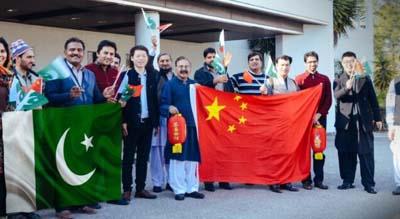
12 Pakistani technicians participate in course to enhance expertise in surveying and mapping technology
Newswire
Islamabad: A group of 12 Pakistani technicians recently participated a course in China, focusing on enhancing their expertise in surveying and mapping technology
The completion of the second technical training aimed at establishing Pakistan’s new generation national geodetic datum, marks a significant milestone, said Pakistani officials.
This training initiative stems from Pakistan’s 2011 request for support from the Chinese government to create a Next-Generation Geodetic Datum.
The ultimate aim of this geographic information system mapping and surveying project is to foster advancements in research and innovation, particularly within the realms of the economy and society.
By forging connections, this project is set to bolster collaboration between scientific and technological communities, public institutions, and governmental bodies.
This commitment was solidified in May 2017 when the governments of Pakistan and China exchanged letters and China pledged financial backing for the initiative.
The significance of this effort becomes apparent in its direct impact on the China-Pakistan Economic Corridor (CPEC), where the geodetic datum will serve as a crucial spatial reference framework.
This framework ensures the accuracy and alignment of mapping and construction activities with the overarching objectives of the CPEC.
Through this comprehensive training program, a team of skilled professionals has been equipped with advanced mapping technology expertise.
This development not only strengthens the bilateral relations between Pakistan and China but also propels both nations towards a more sophisticated stage of innovative development.
